

Connecting North East Calderdale
This engagement is now closed, thank you for taking part.
The feedback has now been analysed and the outcome report can be found here. This outcome report has been prepared by Sweco and has been published on behalf of Calderdale Council.
We are developing plans to make your journey to local town centres and key locations in north east Calderdale better, by improving bus services in the area and making it safer to walk and cycle. By making these changes, we hope that this will help reduce traffic, cut pollution, and improve health and wellbeing in the area.
From Monday 29 September to Monday 10 November 2025 we want to hear your views on our proposals.
In 2021, Calderdale Council asked residents and businesses in Hipperholme, Northowram, Shelf and the wider area for their views on traffic in north east Calderdale and you told us:
There is heavy traffic at the Hipperholme crossroads, the Stump Cross junction, and the Stone Chair junction
Air quality is poor because of traffic
There are not enough safe places to walk and cycle
Bus services are delayed by congestion, especially at busy times
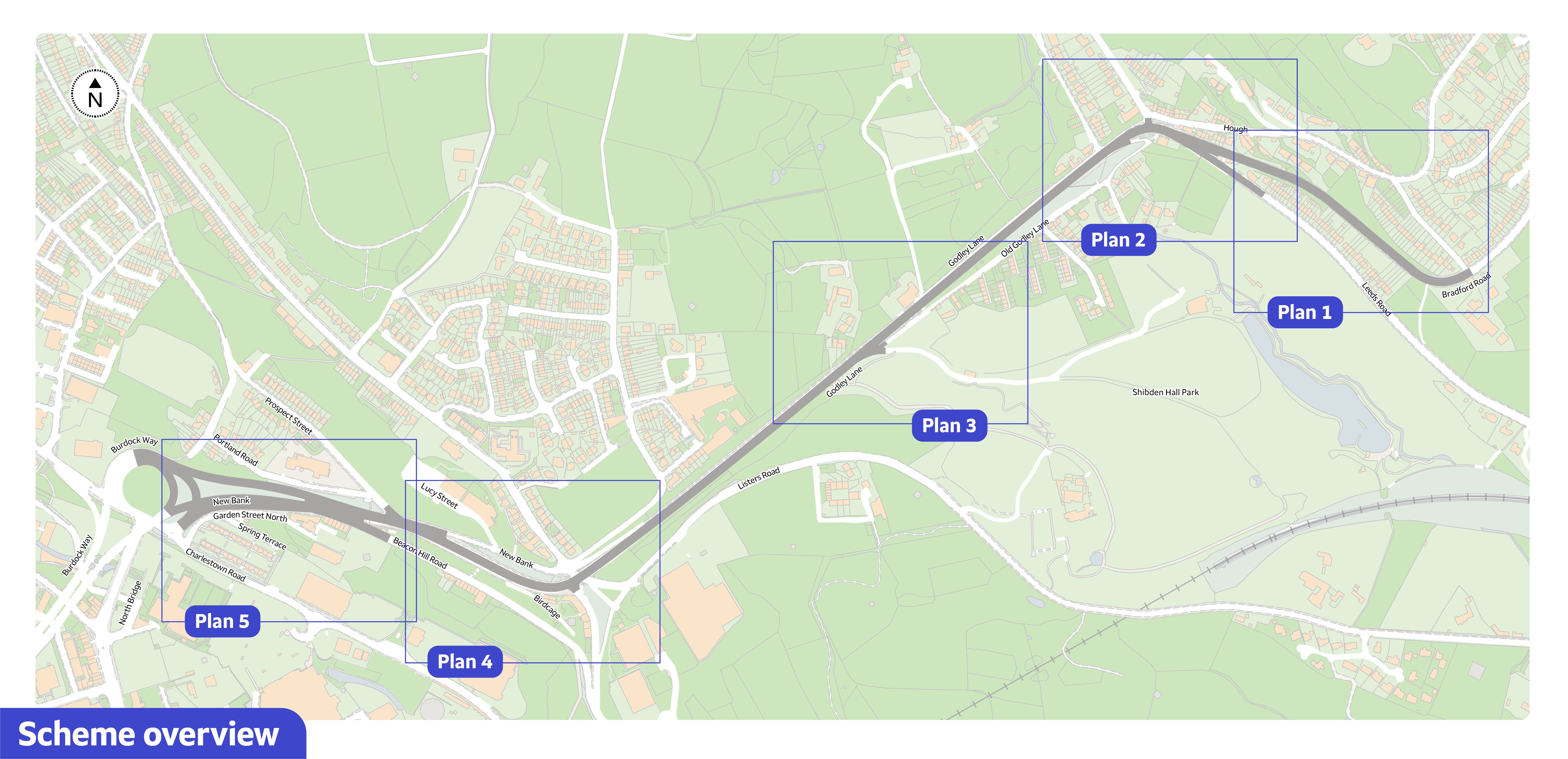
Our proposals
We are proposing upgrades to help improve bus journeys along the A58, focussing on New Bank and Stump Cross. This is the first phase of plans for the north east Calderdale area, with further proposals to be consulted on later. The plans include:
New bus lanes on the Bradford Road at Stump Cross and New Bank
Traffic light upgrades at Stump Cross junction
Puffin crossing at Stump Cross junction
Improved pedestrian access to Shibden Hall Estate
Upgrades to existing bus stops in the area
Have your say
To see our proposals in more details, please view the plans. Once you have read the information, you can let us know what you think using any of the following methods on this page:
Complete our online survey
Ask us a question using the online Questions and Answer tool
View our Frequently Asked Questions
You can also contact us in the following ways, including to request information in alternative formats:
Email on yourvoice@westyorks-ca.gov.uk
Phone (MetroLine Information Service) on 0113 245 7676
Post at FREEPOST WEST YORKSHIRE COMBINED AUTHORITY (no stamp required)
Events
We will be hosting two drop-in events as part of this consultation, which will provide you with an opportunity to learn more about our plans and you will be able to ask questions to the project team. There will be access to paper surveys where you can provide views of the proposals:
Saturday 11 October, 10.30am-2.30pm at Halifax Town Hall, Crossley Street, Halifax, HX1 1UJ
Monday 20 October 4pm-8pm at Belgrave Social Club, 277 Claremount Road, Halifax, HX3 6AW
Next steps
An outcome report summarising the feedback will be added to this webpage. The feedback gathered from this consultation will be considered and will inform the final business case decision.
This consultation will close 11.59pm on Monday 10 November 2025.
This engagement is now closed, thank you for taking part.
As us a question, and the project team will get back to you.
Please note, if you are logged into Your Voice, your username will be displayed when you ask a question.

-
 About the project
- What area does the Connecting North East Calderdale project cover?
- How and why did we choose this area to make improvements?
- Who is leading on the delivery of this project?
- What will be the total cost of the Connecting North East Calderdale project?
- Could the money be spent on other things? (e.g., bus services, other projects)
- Is this project related to the A641 Improvement scheme?
-
About the proposals
- What do we hope to achieve by making the improvements?
- What are the improvements being proposed?
- Why have these specific proposals been chosen?
- Has any transport modelling been done on this corridor?
- How will these proposals make it easier and safer to walk or cycle?
- How will these proposals improve bus journeys?
- How will these proposals affect local residents and businesses?
-
About the construction
-
Taking part in the consultation
